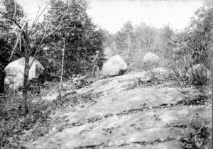
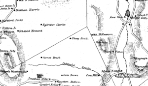
Calumet (Catamint) Hill
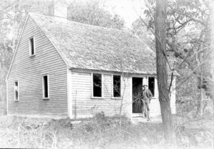
William Emerson Place
Possible Identification: William Emerson (1733-1813)
Possible Location on 1838 map: Wd. H. Emerson, slightly northwest of Catamint Hill (Mt. Calament/Calumet Hill).

In “North Cumberland, A History” by Robert V. Simpson, it says that William Emerson built his house on the eastern slope of Catamint Hill.
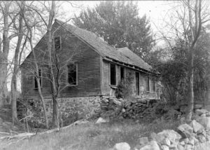
Scott Place
Possible identification: Charles Scott, 1750-1828, Charles Scott, 1759-1840, Olney Scott, 1795-1864
Possible location on 1838 map: Olney Scott, west of Catamint Hill. There is no obvious connection between William Emerson, the Scotts and the Ballous, other that they were neighbors. The following is an extract from Marcia Green’s article on Diamond Hill Park. The photo in the article may show the cellar hole of this house. The abandoned cart road, superseded by 1895 by Pine Swamp Road, must have once connected these houses.
The Valley Breeze, “Explore the “Other” Diamond Hill Park”, 9/10/2014, by Marcia Green.
“We walked west-southwest to find the old cart road, lined with stone walls – far more attractive than Jersey barriers – that Pine Swamp Road replaced in the late 1800s. My 1895 map of Cumberland describes the “new” Pine Swamp Road….
We walked west toward West Wrentham Road to reach the stone foundation of the Scott family home.
It wasn’t hard to imagine the Scott family’s farmland, now covered in trees and overgrowth of ferns, and to speculate about the difficulty of surviving in Cumberland in the late 1700s and 1800s.
A job offer at one of the new textile mills, complete with housing, had to have been very appealing to some.
One-quarter mile up the hill from the foundation, you’ll find Historic Cemetery No. 31, where Charles Scott and wife Amey Briggs and nephew Charles are buried. It’s a little startling to see a graveyard so deep into the woodlands.
Thanks to fine research by Cumberland’s Lester Hilton, you can use an app to find it. The GPS coordinates places it at latitude 42.003950, longitude 71.439554.
Charles, born in 1759 and still a teen when he enlisted as a Revolutionary War soldier, is listed on military records as having a lame hip because of a wound suffered in battle on Aug. 29, 1778, the Battle of Rhode Island on Aquidneck Island, that shortened his leg by about five inches. He died in July of 1840.”